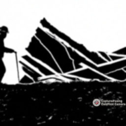
Photo documentation is an invaluable tool when assessing landslide damage and understanding the impact on the landscape. 📸🌍
Before a landslide occurs, capture images of the area to document the current state of the land, vegetation, and geological features. This provides a baseline for comparison after the event. Photograph any potential indicators of instability, like ground cracks or leaning trees. These photos assist in identifying areas at high risk.
Document the movement of debris, changes in topography, and any damage to structures or infrastructure. These images give a real-time account of the event and help in understanding the dynamics and magnitude of the disaster.
After the landslide, take photos to assess the extent of the damage and any changes in the landscape. This helps in quantifying the impact and developing effective mitigation strategies. Capture images of new geological formations or features created by the landslide, such as exposed rock layers or new water channels.
Photo documentation allows us to visualize the changes, track patterns, and make informed decisions. It is a powerful compliance, verification, and data collection tool.


